Showing posts with label Galaxy. Show all posts

Monday, November 14, 2016

֍۩ Campground Review List ۩֍

I have been meaning to get around to this for some time now. It's a daunting task but hopefully it will help any fellow travelers (current or future) who might be reading to find a great campsite for their upcoming trip. A majority of our journey has encompassed California and Utah which are both very beautiful states. Nonetheless, the following will be an ongoing list which will be improved from time to time to include our findings as we continue our tour.

It all started on the East Coast with a dream of adventures. With the huge help of Freecampsites.net, we were able to locate amazing ((and not so amazing)) places to spend a night or longer while we were in 'town'. Freecampsites.net is a user based system where just about anyone can post new places to stay. There is a moderator team to weed out the junk but for the most part, this website has been extremely helpful. The best feature is the user reviews which gives you the actual down and dirty facts of the sites. Locations without review are a bit scary since you don't know what to fully expect but sometimes its the only option in your region and you have to take the plunge. Once you do know the deal however, its best to login and let others know how it went. The database is always improving and we rarely have technical issues with the site. Oh yeah, and the App is just a link to the website so just cut straight to the chase. Be sure to click the Campground name for a link to more information.

As with any campsite or boondock location, always abide by the law of the land including fire safety, adherence to private property/trespassing, trash pack-in/pack-out, proper waste management and attention to potential wildlife like bears, snakes, coyotes, moose, deer, raccoon, skunks, tarantulas etc.

--We are currently also looking at the Campendium website for secondary references. We have yet to try sites listed on there but assume its a very similar structure.--

-JUNE-

11 Twp Rd 181, Bloomingdale, OH 43910
Bloomingdale, Ohio
GPS: 40.334339, -80.764242
Elevation: 1176'

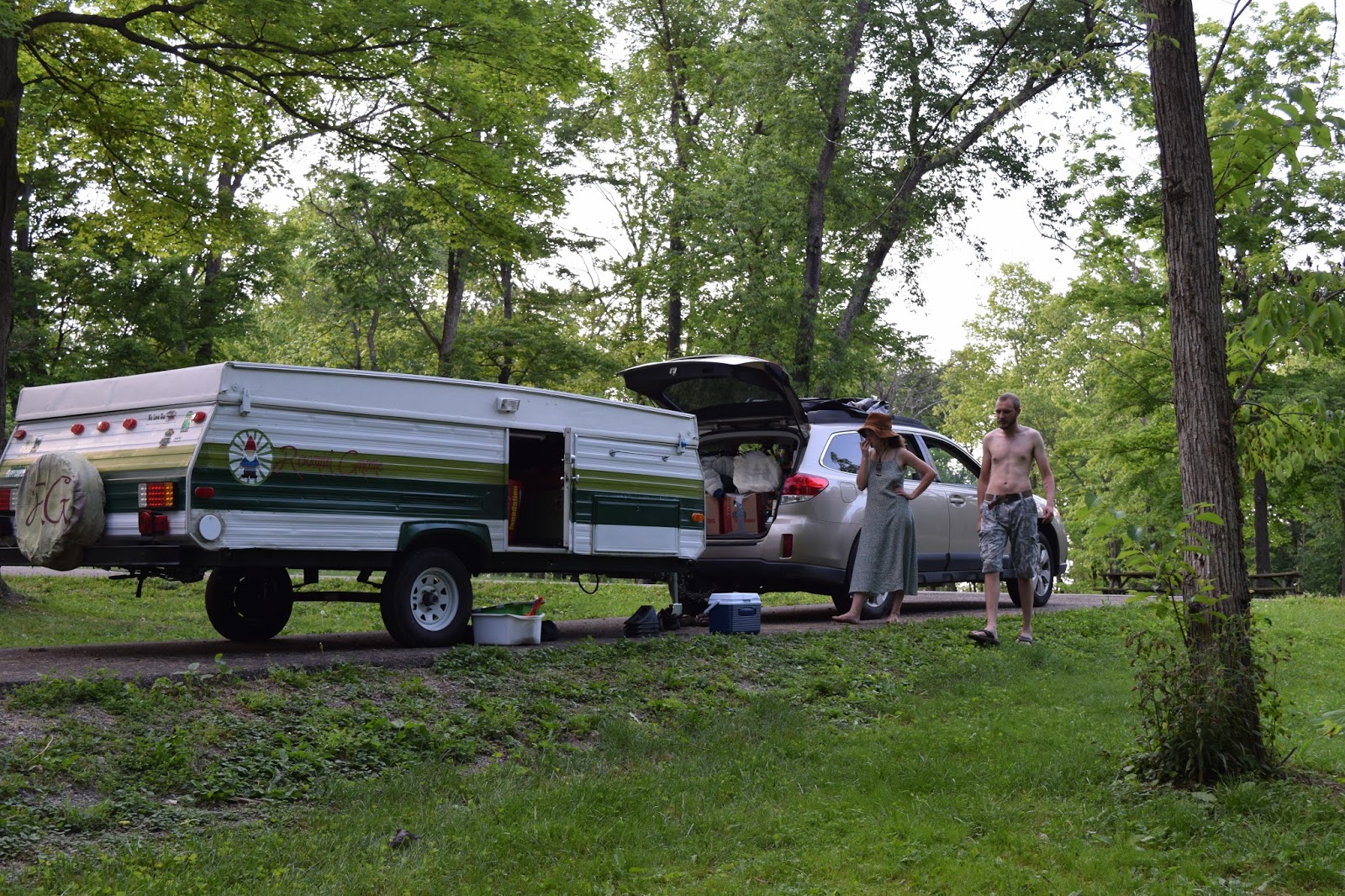
[Camped here for a one nighter on the way through town. Easy enough to find and the long paved sites are great for any rig. Along side each platform is a nice large camping area with ring and table. We arrived during a cicada emergence so the noise was incredible but this was the anomaly. The gun range nearby also allowed for some outside noise. The water tap onsite is listed as non-potable and the drop toilets on site were standard.]
--------------------------------------------------------------------------------------------------------------------------------

Hohenwald, Tennessee
GPS: 35.522797, -87.455078

Elevation: 955'


[Once again, another one nighter through town. Merriwether was an unexpected stop but well worth it. A bit off the beaten path, nestled in the wood, the smaller sites have good pull through or back-ins pads well paved for any sized rig. Fire pit and tables included and FLUSH toilets on-site were well cleaned. There was spot for campground host but none present at the time.]

--------------------------------------------------------------------------------------------------------------------------------

Sanford, Texas
GPS: 35.70639, -101.559998
Elevation: 3012'

[A one nighter to remember at this beautiful campground. We arrive in late afternoon and set up camp at one of the top pavilions. Each site has a pit and picnic table with sturdy pavilion on pad. Sites are on the smaller side and limited privacy if full. Flush toilets and water for rigs provided and an amazing view of Lake Meredith. We watched a storm roll in from afar and by midnight, intense winds and lighting pushed us into the car for the night. Not the best nights sleep from the freak storm]

--------------------------------------------------------------------------------------------------------------------------------

HWY 117
Grants, New Mexico
GPS: 34.941908, -107.820155
Elevation: 6898'

[One of our favorite sites was located at this desert site. The location was fairly vacant but the slope and vegetation allowed for better privacy. Each site had a shade pavilion and picnic table (no fire pit) and great views of the lava flow lands to the west. Mind the dip at the entrance to the CG which might get some towers stuck in the rut. Unpaved lots might be more difficult for some rigs. Drop toilets on site were clean and cared for during our visit.]

--------------------------------------------------------------------------------------------------------------------------------

Bryce Canyon, Utah
GPS: 37.721502, -112.254688
Elevation: 7816'

[The first night we were in this region, we stayed in the paid Dixie NF campground. With a short drive, we found this location on a whim and set up camp on one of the turnouts. SUPER Private sites off the beaten path with improvised fire rings. Might be a bit windy on some of  the Mesa sites but incredible views and no outside noise. Close to Bryce and Dixie with a medium drive to Zion. No other amenities so bring your own facilities and water.]

--------------------------------------------------------------------------------------------------------------------------------

29450 Valley of Fire Road
Overton, Nevada 89040


[Stayed at this location outside of Las Vegas area. A $20 fee ($30 for hook-up site) is charged for the use of camping areas and is payable at the campgrounds. All campsites are first-come, first-serve. There are two campgrounds with a combined total of 72 units. Campsites are equipped with shaded tables, grills, water, and restrooms and have minimal privacy. A dump station and showers are available at cost. Facilities were clean but well used.]

--------------------------------------------------------------------------------------------------------------------------------

Hope Valley, California
GPS: 38.765404, -119.940048
Elevation: 7111'


[Spent about two weeks at this busy site +/- the July 4th holiday. Ripe for off road rigs including dirtbikes, quads and buggies, this location is very popular with all sorts. About 40 minutes from the S Tahoe Region, this camping area allows for about 20 unimproved sites with improvised fire rings. A short but difficult '4x4 suggested' drive gets you to Scott's Lake with amazing views of the mountains and pines. A must see. No other amenities so bring your own facilities and water.]


--------------------------------------------------------------------------------------------------------------------------------


-JULY-

Occupy Dinkey Creek

-AUGUST-

Occupy Dinkey Creek

-SEPTEMBER-

Occupy Dinkey Creek

Coalinga Road
King City, California
GPS: 36.368169, -120.83103
Elevation: 2861'


[A weekend trip led us to this small 5 site campground in the hills west of Fresno. The location has a few other campgrounds which support more/larger rigs but this one was right for our tenting that time. The sites were small so leave the giant tents and supplies at home. Drop toilet was clean and the sites were well maintained. Good view from the top sites and private camp locations provided for a good time. Take the hike past the metal barricade for some amazing Serpentine rock samples which shimmer in teals, blues and purples. Also, a season waterfall is a 3 mi. hike down the trail. No water or shops nearby so BYO]


--------------------------------------------------------------------------------------------------------------------------------

Lakeshore, California
GPS: 37.33314, -119.15334
Elevation: 7828'


[Spent a weekend at this location while exploring Mono Hot Springs, a free use series of hot springs in the hills past Kaiser Pass. This location was great because it was free AND we were allowed camp fires. Each location has a fire ring and one or more well used picnic tables. Drop toilets were well worn and could use updating. Look for the last site to the right of the metal barricade before the bridge. Very private with lots of wooded areas to explore and enjoy right by the stream.  No water or shops nearby so BYO]


--------------------------------------------------------------------------------------------------------------------------------

Dinkey Creek Road
Shaver Lake, California
GPS: 37.096035, -119.296593
Elevation: 5743'


[Numerous roadside pull-offs allow for camping in the woods of the Sierras. We made camp at a pull-off from Swanee Road (no signs/see GPS suggestions) at an established camp. Mind the fire restrictions in place and also note hunting season if applicable. We bought Ziggy a high-vis vest after hearing numerous gunshots in the area. Safe none-the-less and right outside of Shaver Lake which offers small scale convenience stores, places to eat and outdoor outfitters. Roads are unimproved, dirt, or gravel with potential for heavy rutting. If you bring a big rig and want  deep spot, best to unhitch and do some homework before travelling the route. Stay away from the first pull-out which becomes super crowed and opt for a more private location. No water or facilities so BYO]

--------------------------------------------------------------------------------------------------------------------------------

-OCTOBER-

Mount Raymond Road
Fish Camp, California
GPS: 37.491415, -119.624698
Elevation: 5276'


[Right outside the East entrance to Yosemite, this area was great for a short stay with numerous small locations to park up and stay. A lot of spots were on a hillside and not great for large rigs but tents will do fine. The flatter spots tended to fill up quickest so stake your claim ASAP. Also, RV's parked on the paved pad which was level and sturdy. Access road is gravel in great condition and landing has a bear-proof large garbage nearby for your trash. Other than that no water or facilities so BYO]

--------------------------------------------------------------------------------------------------------------------------------

Picnic Grounds Road
Lee Vining, California
GPS: 37.944889, -119.093529
Elevation: 6732'


[Excellent site off the beaten path and a short drive from the Mono Lake Tufa's, Lee Vining and the East Entrance to Yosemite. Follow the narrow sandy path to your private location of choice to set camp under the stars in the vicinity of volcanoes and massive mountains. Make sure to mind the potential for coyotes in the area as we had a pack howling each night. No water or facilities so BYO]

--------------------------------------------------------------------------------------------------------------------------------


Main Street
Big Pine, California
GPS: 37.173313, -118.289261
Elevation: 3960'


[We originally attempted to make it through to the campground near the Ancient Bristle Cone Pine Forest but with night upon us and a long day of driving behind, we opted for this paid location at the foothills of the ABCPF. Liz made use of the affordable showers and the clean bathrooms onsite were nice to have. The sites are small and cramped but fine for a night or two. It is right off the highway so noise is a bit of an issue throughout the night. Hook-ups are available for a nominal fee in addition to the normal cost. A campground host is present so this is a no-party zone. Potable water from the spigot is provided.]

--------------------------------------------------------------------------------------------------------------------------------

39.282993, -114.949613
Ruth, Nevada
GPS: 39.282889, -114.949555

Elevation: 7290'


[Arriving late at night and leaving early the next morning, we had little time to explore the area but the camping did the trick for what we needed. Follow OFFICIAL signs for Garnet Hill (seeing as how our GPS tried to take us down the worst dirt road ever), and make sure to keep momentum as you tend to the hill. We found camping spots along the left side of the road as you near the summit. At the top is a drop toilet well kept and few tables but actual camping at this area might not be allowed. Find your camp off the dirt road and use already established fire pits. Make sure to whip out your hammer and smash some rocks to search for some deep red garnets. Ely has grocery and gas nearby to restock.]


--------------------------------------------------------------------------------------------------------------------------------

Hanksville, Utah
GPS: 38.277878, -111.130745
Elevation: 5171'


[A beautiful place to boondock, this location is right outside the boundary of Capitol Reef and sits atop a mesa. We encountered a freak wind event which led us to a lackluster nights sleep in the Subaru. None-the-less, a fairly easy camp to access in most/all rigs with user built fire rings. Fairly flat parking provided a good spot for most setups and privacy is OK if your neighbors aren't too close. No water or facilities so BYO]

--------------------------------------------------------------------------------------------------------------------------------

191 and Yellow Circle Road
Moab, Utah
GPS: 38.435474, -109.427631
Elevation: 5298'


[A great location on the southeast side of town, this camping area accommodates numerous groups with limited privacy. The exposed sites offer great views of the surround landscape and sunsets and has a few trails to explore up the hills. 25 minutes outside of town and about 40 mins to Arches, this site is a bit further but less popular than the overcrowded locations to the west of the parks. We spent the better part of a week at this location while enjoying the area. No water or facilities so BYO]

--------------------------------------------------------------------------------------------------------------------------------

Lake Como Road
Blanca, Colorado
GPS: 37.526985, -105.593536
Elevation: 7680'


[This free site is good for a half dozen campers at the foothills near the Great Sand Dunes of southern Colorado. The road slopes up towards the mountains so level ground might be hard sought unless you can (and want to) snag the immediate sites on the flat. The road is quite wash boarded so watch your speed and position. Little privacy aside from distance from neighbors and no nearby amenities. No water or facilities so BYO]

--------------------------------------------------------------------------------------------------------------------------------

Road 254
Utah
GPS: 37.601438, -109.923472
Elevation: 6998'


[A quick overnight between locations led us to this location. It is close to Natural Bridges National Monument and offers a handful of pull-off locations along a dirt road. I would not recommend for larger rigs and those that cannot clear a gap. The area is prone to wash-outs so be careful before and after heavy rains. We set camp in a wooded nook for the night. No towns or amenities to speak of so BYO.]

--------------------------------------------------------------------------------------------------------------------------------

Lockhart Rd
Moab, Utah
GPS: 38.1795, -109.66695
Elevation: 4917'


[Another favorite location in the middle of the desert and a stones throw from Canyonlands Needles District entrance. This no frills series of sites along Lockhart road offer nice private locations and stunning views of the surrounding canyons and valleys. Take some time to explore the local climbing features on the red slick rocks. We spent two night but would stay more if we had the time. No towns or amenities nearby so stock up and BYO.]

--------------------------------------------------------------------------------------------------------------------------------

-NOVEMBER-

Logan Canyon, just past 2nd dam
Logan, Utah
GPS: 41.746998, -111.733063
Elevation: 5036'

[A one nighter while passing through left us with Logan Canyon. At this time of year, sites were closed and gated along this road so be prepared to reroute. In normal season though, this camping location is prime with people along this major road. We did not specifically stay in this listed location but there are numerous sites along the road to camp up at. We stayed along the river and left in the early AM to continue our journey. Potable water and toilets may be available depending on the season.

Ennis, Montana
GPS: 45.443633, -111.706658
Elevation: 4836'


[The beautiful mountains of Montana gave us an amazing background for our two nights outside of Ennis. The quiet and semi private campsites allowed for a good nights sleep along the banks of the lake. Fire pits and picnic tables provided along with a clean and stocked drop toilet gave this campsite two thumbs up. Ennis' small town western feel synced up with its nearby access to Yellowstone's western entrance. Great campground at a great location.]


--------------------------------------------------------------------------------------------------------------------------------

Saco, Montana
GPS: 48.488739, -107.531288
Elevation: 2247'


[A mighty fine site along a lake once more provided us with a safe and quiet place to spend the night. Large pavilions with numerous picnic tables and improved fire pits allows for large groups to attend. There are also numerous drop toilets along the banks for easy access. The campsite is a bit out of town so be sure to stock up  on goods. The nearby Sleeping Buffalo Hot springs is said to be a treat in its newly renovated form. We were unable to attend since they were closed on Mondays and Tuesdays.]


--------------------------------------------------------------------------------------------------------------------------------

CURRENT AS OF NOV 15.

Tuesday, July 12, 2016

The Working Gnome

After a beautiful two week visit to the Tahoe area, we were ready to go. Much of our time spent in this area was in the Library frantically looking for work. When last we left, our funds were waning and the need to work was growing. Our initail intent was to work at a campground but at a certain point, we were desparate for just about anything including craigslist gigs. We applied to just about every open position for campground host on the west coast with only a couple call backs in the works. One of the call backs was from Clayton with the California Land Management team. He was genuinely  interested in our application; either that or he was just desparate for a toilet scrubber. After numerous calls and a bit of negotiating  on my end, we were offered the position for campground host/hostess/dogst at the Dinkey Creek CG near Shaver Lake in the Sierras!! The position is exactly what it sounds like; guest check in and info guru who also cleans the facilities on site in addition to any minor fixes that might be necessary. Additionally, Liz will be allowed to drive a golf cart and/or pickup on site. (Their insurance wouldnt cover me due to a driving infraction from 2012 :( oh well. I might just buy a bicycle to jot around)

As we drive towards our new working world, a small pit of nervousness is present about our duties and new home for the next few months. We intent to stay through the season up till September. A Costco stock up will supply our stomaches for a while since the nearest store will be miles and many minutes away and only supply the basics at a premium. We dont know what to expect with connectivity to the outside world so all responses may go unread/unanswered for a time until we can get to a 3g spot.

The pay aint great but it should be enough time to refill the accounts for a while. Also the ability to add this to our resume will help in securing other prospects in the future. Finally, the gnome gets a free home far from worry about stay limits or camp fees which quickly add up. I think we're gonna rock this opportunity and have a blast making friends (and maybe a few foes who dont follow the rules) who too travel in search of adventures on the road.

-Gnome Team out

Tuesday, June 28, 2016

☆ Red Rocks and Butterscotch (LINK)


In lieu of my own creative spin on our adventures, please check out Liz's well worded(and pictured) posting of our trip to Dixie NF, Zion and Bryce NP. The trip with Sara and Colin had alot of great times and memories made. Glad they were able to join the gnome for a week of fun in the desert.


A Grand Experience

When we last left off, the gnome was en-route to a site in Sanford Texas. The campground upon arrival sat atop a bluff overlooking Lake Meredith in Sanford Texas. The site were spacious and fresh water provided upon entry. Additionally, the bathrooms were immaculate and had free showers! But the view though. 


The gnome sat dormant another night while Liz and I made camp in the tent. As the evening drew near, a storm was seen rolling in to the north. Lightning silently flashed the sky in the far distance. We tucked in for the night around 10. The radar said there was an 8% chance of precip and yet the rain drops coming in through the open top tent made us rap the rain fly for the night. 


We did not know what was in store. 


Around 1:30AM the wind started and didn't stop. Strong gusts pushed in the roof of the tent and rain pelted the fly above our bodies. Lightning was upon us and would light the tent with a crashing boom instantly. The storm had shifted and was right overhead. For safety sake, we pack the dog, tent and some pillows in the Subaru and got "comfy" for the night. Sleep finally came but was irked away with the rise of the sun on the vista. With eyes somewhat open, we gathered whatever belongings we had, got organized and headed out. Aside from the freak storm, this was a beautiful, well kept site with nearby lake like amenities and would visit again if in the area.


On our way out of Texas, we stumbled upon Cadillac Ranch outside of Amarillo Texas. We couldnt help but stop and take pictures of cars that had been stacked in 1974 by Chip Lord, Hudson Marquez and Doug Michels who were part of the art group Ant Farm. The car shells have gained fame for their unique appearance that changes with each visitors spray of the can. Just remember to clean up the cans when done.


For the night, we made camp in El Malpais (Badlands) National Park at the Joe Skeens Campground. This site had about 2 dozen areas to camp which includes newly built pavilions and clean drop toilets. The location is fairly off the beaten path which made it a quiet night with very few neighbors. The local views and opportunities for exploration in rock crevices, caves and lava flow fields made this an ideal camp for the night. While in the desert, we couldn't resist buying sparklers at the local fireworks shop and doing some long exposure images.


On our way out of town, we checked out the nearby vista which was fun to climb around on. Our drive through the desert continued with a stop through the Painted Desert and Petrified Forest NP. Petrified Forest National Park is known for its fossils, especially of fallen trees that lived in the Late Triassic period of the Mesozoic era, about 225 million years ago. During this period, the region that is now the park was near the equator on the southwestern edge of the supercontinent Pangaea, and its climate was humid and sub-tropical. What later became northeastern Arizona was a low plain flanked by mountains to the south and southeast and a sea to the west. Streams flowing across the plain from the highlands deposited inorganic sediment and organic matter, including trees as well as other plants and animals that had entered or fallen into the water. Although most organic matter decays rapidly or is eaten by other organisms, some is buried so quickly that it remains intact and may become fossilized. Within the park, the sediments containing the fossil logs for which the park is named are part of the Chinle Formation


Off to Flagstaff we flew. The gnome set up camp at a free site off a dirt road north of town. We were met with a dozen other free campers who used the space to spend a night or two. Just driving through the town, we knew it was something special. The quaint local shops and unique spaces almost masked the sad homeless side which was seen on popular street corners and in the parks. Aside from that, the city had a great overall vibe to it. 10 outa 10 would visit again.


The morning after arriving to Flagstaff, we heard a rustle around 6AM. We peek outside the curtain and sure enough, we see Sara and Colin packing up their tent into the rental  car. They anticipated finding camp an hour north at the South rim of the Grand Canyon but were unable to secure a location where ever they went. They instead headed to our camp and spent the night in-tent. They were able to salvage their trip to the Grand Canyon that morning with a quick in and out of the tourist spots while Liz and I stayed around to explore Flagstaff and do laundry at the local coin-op. In the early afternoon, all parties were present in Flagstaff for the final push to Vegas and further to the main attractions; Dixie NF, Zion and Bryce NP.


Driving into Vegas at dusk, we headed to the airport car return to get Sara and Colin situated. The clouds were a beautiful pink and purple swirl ominously billowing above our heads. It may have been a sign of things to come. The rental was returned without issue and all four humans, one dog and a 33 year old camper headed into the Red Rock Canyon Nat Conservation Area to find some BLM land to camp. Little did we know that such a feat would be impossible to accomplish and leave us stranded with no where to stay for the long desert night in the deserted outskirts of Las Vegas.


Monday, June 6, 2016

In it to win it

So with our shake down cruise through Virginia completed, all possible fixes / additions made to the camper, our equipment checked and packed, and plans for the next few weeks at the least, we set off. The camper was near packed from Memorial Day weekend which was spent with good friends at a great camp site near Scranton PA. After saying our goodbyes for a while, we headed back to Harrisburg for one final night before hitting the road for good; or so we thought.

The original plan was to depart on the 31st but apparently Ziggy had other plans. With everything packed, we went to fetch the dog to load him in. He was extremely lethargic and refused to get up or put any weight on his back leg. The timing couldn't have been worse but he is a member of the family and deserves care so we booked a trip to the animal hospital to get everything checked out. $100 later, he is issued some pain pills for a bruised ligament in his leg. Funny how by the time we got home from the vet, he seemed much better. We used the unexpected night at home to revamp some of our plans since now we had one less day to get to Vegas.

The next morning, we are already packed so we just pile into the Subie and hit it. On our way out there, we had arranged to pick up a newly found friend, Jessi, in Camp Hill PA and give her a ride back home to Kentucky. Since we were headed that way anyways, it wasn't much of an issue to offer the ride. The gnome arrived to Camp Hill, acquired its last passenger and gear including four boxes of hand made pottery amongst other things and set off for the first camp site in Ohio. The drive through PA was nothing new since we have been used to the rolling highways loaded with trucks.


As we arrived to our first camp called Hidden Hollow near Bloomingdale OH, we passed multiple gun firing ranges which was a bit off putting. Additionally, this area of the country was currently going through a cicada bloom and thus the noise level of buzzing bugs was deafening and the shells husks littered the grounds as if a mass casualty had occurred. On top of it all, humidity was about 90% and the sweat effortlessly came from all parts of the body leaving a not so fresh feeling. Since the Roamin Gnome is in travel mode to get to Vegas, Liz and I had decided to NOT pop the camper each night to save time and energy with set up/tear down. We planned to use our small 2 person tent but until that moment, had not accounted for Jessi and her sleeping spot. Luckily, she was game to sleep in a hammock under and well supported tarp. That night in the tent was humid and slugs crawled everywhere inside while other bugaboos flapped outside. Jessi had a great setup through which had good airflow and protection from most of the crawlers.


The vehicle was loaded and we waved bye bye to Hidden Hollow campground which we would rate 4/5 stars for cleanliness, accessibility and lot size. Dont drink the water through as the parks no longer test for drink ability and with nearby fracking operations, its hard to tell what might not be safe to drink.

Prior to arriving at Jessi's mothers, we stopped by an effigy in OH called Serpent Mound which was built by early native people for purposes still unknown to researchers. The mound does work with the sun and moon though to give an accurate calendar of sorts. Its also believed that sacred rituals took place upon the hill.


In the early evening, we arrived at our destination exhausted and ready to rest. Food was just about ready which was prepared amazingly by Jessi's mom, Karen. With a clean, dry bed, air conditioning, a hot shower and meal in us, we gladly accepted the hospitality.


Morning came too soon and all things once again were loaded up sans Jessi and her four boxes of pottery; of which we purchased two pieces off her before the general public got to get their grabby hands on the beautiful glazed dishes, bowls and cups.


The gnome headed south through KY and onto TN to meet our next camp in Merriwether Lewis Death and Burial site. I know this doesn't sound amazingly appealing but when we arrived at dusk in a light rain, it was home for the night. The free campsite was nearly empty with a few neighbors scattered nearby. The facilities included very clean FLUSH toilets, well kept water taps, trash at each site (or shared) and numerous pull through spots, earning a 5/5 stars thus far.

The next morning, we quickly packed to get out of the rain that continued to plague our trip thus far. I knew that it was just a short time more in the western direction before rain is no more and we are into tanning land. Tennessee was beautiful but desolate at times with huge highways built to accommodate a population that is yet to exist in the area. I will happily take a multi-lane highway all to myself thank you. At lunch, we stopped in Memphis to appreciate the Bass Pro Shop Pyramid which was listed in Roadside America as the largest in the US. At 25 stories including a massive outfitter store, an observation deck (10$) and even hotel rooms; the place was massive and yet at times, claustrophobic. Knowing that our time in the sun was soon to come, we cashed in some gift cards to purchase hats for ourselves. Hopefully a good purchase for the future.


We took a short detour to the Little Rock AR airport to see my fathers company facility. He travels here frequently so why not drive around and check it out.


Onward into Arkansas from Memphis, we hit our next camp near Toad Suck AR. The camp was installed by the Army Corp of Engineers what looked like a plot and drop notion. The now severely over grown grounds COULD host about a dozen sites but the weeks and tangles prevented most from use. The boat launch nearby was the only thing keeping the locals coming back. A quick machete action and our camp for the night was cleared in this very private camp with ZERO working amenities. Instead of the rainfly for the tent, we opted to use the Kelty tarp, a move we will use more often since it included airflow 100 fold but still gave protection from the elements.


Pack at it again, we load up our AR camp to continue westward to get to the hotel that Liz had booked in Oklahoma City. We didn't stop for much sight seeing on this leg as there wasn't much to see aside from a straight highway with amazing puffy clouds. There were casinos though at about every stop along the way. We didnt play.


Welcome home to Oklahoma City OK. Our currently location where this post is being made and sent. We are lucky to have internet connection since it seems every other thing about this hotel was a lie. This Motel 6 seems to but under new management and thus is going through changes like the truck that is loaded with old beds to be dumped, the elevator that had the smell and then visible puddle of urine in it, the laundry facility and continental breakfast that doesn't exist and more. The sheets were filthy so we used a good old tapestry and our sacks for the night. This place will NOT be missed.


THE FUTURE: It might be some time before another post comes out. We will be on the road and who knows when we might achieve internet. Our upcoming journey in brief includes a stop in Sanford TX tonight followed by a nice desert venue in NM the next. Then its off to Flagstaff before meeting up with Sara and Colin in Vegas. Our vices will not hold as we rush towards Zion, Dixie NF and maybe Bryce Canyon if we have the time. Our boon docking skills will be tested as we try to figure out BLM (Bureau of Land Management) camping which is free but requires registration from the local authorities.

Once done with Zion et al, we anticipate a short drive to San Diego where we have an undetermined camp site but never the less, will have a great time seeing Liz's sister Kathryn.

And post that, who knows. Maybe Colorado calls and we head north before the cold comes back. More WWOOFing on the west coast? One thing is for sure, it's going to be an adventure to never forget.

Thanks for reading.

Sunday, April 24, 2016

The Reward

Its done. Well at least for the most part. The past year and probably a few thousand man and woman hours spent thinking, designing and crafting, cursing when it breaks, and recrafting our adventure-mobile and its finally hit the road.
On April 19th, Liz, Ziggy and myself packed the Subaru Outback and said our goodbyes to our host Mark Fulton. The camper was already packed and ready for the road. We hesitate. Its been so long thinking about this final moment.

And then we left.

I had planned out a few spots to stop to get to our first campsite. First along the way was Great Falls National Park in McLean, Virginia. The historic location was a meeting grounds between native Americans and the colonists. It also hosted a canal used to bypass the rapids and falls that cascaded that section of the River. We pull up to the entrance and much to our surprise, the $10 admission was waved for this week for all National Parks including forests, monuments, coastal zones etc. SCORE!
The Subie and Camper get parked in the way back nose bleeds and we walk to the visitor center. Ziggy managed to keep his cool most of the time while other dogs walked by. The paved trail took us to numerous lookouts along the rapids and falls. Our favorite was lookout 3. Some visitors were nice enough to take some pictures.


Moving onward, the Roamin Gnome travelled south into Virginia which I am told is for lovers. The highway takes us to a local road. Then a nice winding road through George Washington NF and then to a dirt road. We have a quarter tank of gas and w just turned down a dirt road for our first night with the camper. Meanwhile its rounding 6:30pm. The Subaru handles the rocky road like and champ and the new axle provides a nice ride for the house on wheels and its contents. The road continues and a few miles and then we see it.  A sign pointing us in the right direction for the Little Fort Camp Ground. A short drive through the 8 site campground tells us which spot to park the gnome. Backed in and beautiful, we staked claim to the roomy and private site 6.


Our first time unpacking it all and we did fairly well. The sun was still setting and we had more than enough light to make camp including awning placement, hammocks and the cook station. Liz whipped up and amazing meal using the following canned items: Chicken from Costco, black beans, tomato sauce and BLANK. Cooked on the cast iron skillet and served with chips, sour cream and shredded cheese; the only thing that could make it better would be bacon. Eat, clean and rest. The tie dye bed is made and we turn in for the night.


The next morning, we awake to what sounds like a chainsaw right outside our camper. WTF! We sneak a look through the bed windows and its an official park employee trimming the bushes around the drop toilet. We at least he meant no harm. The guy does his job and then walked up the trail. As he approaches, he asked if I had a jumper. Apparently the office installs radios in their work trucks that continually drain the battery. Smart!

After the jump, he thanks me and introduces himself. Charlie has worked for the parks system for 15 years and loves it. Retired navy, he was the kindest guy who gave us the hot tip to a natural spring well nearby and the Firetower up the road. He also gave us two smokey the bear bandanas and gave Zig some doggie biscuits. Aside from Charlie and another woman camping, we had a very secluded and enjoyable day thus far. After a leisure stroll of the campground, we begin to forage for a snack. Our guide books i.d. dandelion root and violets are good grub. The violet heads can be plucked and eaten on the spot. The dandelion roots need to be cleaned and cooked before serving.

In the afternoon, another couple miles of dirt/gravel roads lined with campers and scary shacks led us to the fresh water spring. We fill our water jugs and the 5 gallon shower for later use. On the way back to our camp, we drove up the fire tower road and then followed a short trail to reach the base of the Woodstock fire tower. I was able to muster the confidence and beat my fear of heights to summit the 50 stairs to the top. The  view was fairly stellar and showed the valleys of the region along with a serpenting river.

Back at camp, we unpacked the water and fell victim to a leisure lul. For dinner we had mac and cheese with sauteed dandelions (which were really bitter)oh well. That night slept well.
In the AM, we broke camp and packed it all in to head for Shenandoah. We entered through the north gate waiving the $20 entrance fee and drove Skyline Drive for the 30 something miles till the Luray exit. Unfortunately, due to a massive wildfire in the southern portion of the park, a majority of the route was closed and the vistas were hazy due to smoke wafting. Hopefully the firefighters can get the blaze under control but its a pretty big one.


We exited Shenandoah through the Luray exit and drove Route 211 to 81 and then right through the center of Harrisonburg which is a tight circle in a busy area. Great for a pop-up to zip through. Our next campsite was once again in a length of George Washington NF at Hone Quarry. This one night stop by a stream was a great for the night with the small fee of 5$. During the night, we went frog hunting and came across this Fowler's Toad who was very photogenic.


In the AM we wasted no time packing up to head out before the rain came through. With camper and family packed in, we headed south once more to head for our next camp, Oronoco Campsite outside of Buena Vista VA. We plan to set up base here for the next few days (sans cell/wifi reception) before heading out to our first WWOOFing experience starting next Monday at Sylvanaqua Farms in Earlysville VA. We plan to spend a week with this endeavor before moving on to the next leg of our adventures. Stay tuned and thanks for reading.