I have been meaning to get around to this for some time now. It's a daunting task but hopefully it will help any fellow travelers (current or future) who might be reading to find a great campsite for their upcoming trip. A majority of our journey has encompassed California and Utah which are both very beautiful states. Nonetheless, the following will be an ongoing list which will be improved from time to time to include our findings as we continue our tour.
It all started on the East Coast with a dream of adventures. With the huge help of Freecampsites.net, we were able to locate amazing ((and not so amazing)) places to spend a night or longer while we were in 'town'. Freecampsites.net is a user based system where just about anyone can post new places to stay. There is a moderator team to weed out the junk but for the most part, this website has been extremely helpful. The best feature is the user reviews which gives you the actual down and dirty facts of the sites. Locations without review are a bit scary since you don't know what to fully expect but sometimes its the only option in your region and you have to take the plunge. Once you do know the deal however, its best to login and let others know how it went. The database is always improving and we rarely have technical issues with the site. Oh yeah, and the App is just a link to the website so just cut straight to the chase. Be sure to click the Campground name for a link to more information.
As with any campsite or boondock location, always abide by the law of the land including fire safety, adherence to private property/trespassing, trash pack-in/pack-out, proper waste management and attention to potential wildlife like bears, snakes, coyotes, moose, deer, raccoon, skunks, tarantulas etc.
As with any campsite or boondock location, always abide by the law of the land including fire safety, adherence to private property/trespassing, trash pack-in/pack-out, proper waste management and attention to potential wildlife like bears, snakes, coyotes, moose, deer, raccoon, skunks, tarantulas etc.
--We are currently also looking at the Campendium website for secondary references. We have yet to try sites listed on there but assume its a very similar structure.--
-JUNE-
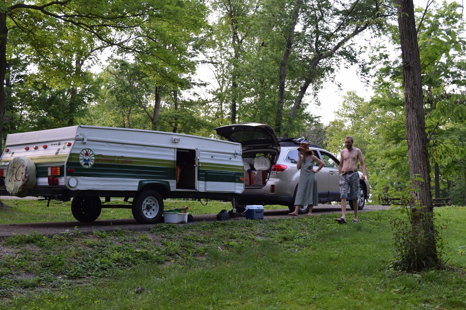
1. Hidden Hollow Campground - Free
11 Twp Rd 181, Bloomingdale, OH 43910
Bloomingdale, Ohio
GPS: 40.334339, -80.764242
Elevation: 1176'
[Camped here for a one nighter on the way through town. Easy enough to find and the long paved sites are great for any rig. Along side each platform is a nice large camping area with ring and table. We arrived during a cicada emergence so the noise was incredible but this was the anomaly. The gun range nearby also allowed for some outside noise. The water tap onsite is listed as non-potable and the drop toilets on site were standard.]
--------------------------------------------------------------------------------------------------------------------------------
2. Merriwether Lewis Campground - Free
Hohenwald, Tennessee
GPS: 35.522797, -87.455078
Elevation: 955'
[Once again, another one nighter through town. Merriwether was an unexpected stop but well worth it. A bit off the beaten path, nestled in the wood, the smaller sites have good pull through or back-ins pads well paved for any sized rig. Fire pit and tables included and FLUSH toilets on-site were well cleaned. There was spot for campground host but none present at the time.]

--------------------------------------------------------------------------------------------------------------------------------
3. Sanford-Yake Campground - Free
Sanford, Texas
GPS: 35.70639, -101.559998
Elevation: 3012'
[A one nighter to remember at this beautiful campground. We arrive in late afternoon and set up camp at one of the top pavilions. Each site has a pit and picnic table with sturdy pavilion on pad. Sites are on the smaller side and limited privacy if full. Flush toilets and water for rigs provided and an amazing view of Lake Meredith. We watched a storm roll in from afar and by midnight, intense winds and lighting pushed us into the car for the night. Not the best nights sleep from the freak storm]

--------------------------------------------------------------------------------------------------------------------------------
4. Joe Skeens - El Maplais Campground - Free
HWY 117
Grants, New Mexico
GPS: 34.941908, -107.820155
Elevation: 6898'
[One of our favorite sites was located at this desert site. The location was fairly vacant but the slope and vegetation allowed for better privacy. Each site had a shade pavilion and picnic table (no fire pit) and great views of the lava flow lands to the west. Mind the dip at the entrance to the CG which might get some towers stuck in the rut. Unpaved lots might be more difficult for some rigs. Drop toilets on site were clean and cared for during our visit.]

--------------------------------------------------------------------------------------------------------------------------------
5. Tom's Best Spring Road Boondocking- Free
Bryce Canyon, Utah
GPS: 37.721502, -112.254688
Elevation: 7816'
[The first night we were in this region, we stayed in the paid Dixie NF campground. With a short drive, we found this location on a whim and set up camp on one of the turnouts. SUPER Private sites off the beaten path with improvised fire rings. Might be a bit windy on some of the Mesa sites but incredible views and no outside noise. Close to Bryce and Dixie with a medium drive to Zion. No other amenities so bring your own facilities and water.]

--------------------------------------------------------------------------------------------------------------------------------
6. Valley of Fire State Park Campground - Paid
29450 Valley of Fire Road
Overton, Nevada 89040
Overton, Nevada 89040
[Stayed at this location outside of Las Vegas area. A $20 fee ($30 for hook-up site) is charged for the use of camping areas and is payable at the campgrounds. All campsites are first-come, first-serve. There are two campgrounds with a combined total of 72 units. Campsites are equipped with shaded tables, grills, water, and restrooms and have minimal privacy. A dump station and showers are available at cost. Facilities were clean but well used.]

--------------------------------------------------------------------------------------------------------------------------------
7. Scott's Lake Campsite - Free
Hope Valley, California
GPS: 38.765404, -119.940048
Elevation: 7111'
[Spent about two weeks at this busy site +/- the July 4th holiday. Ripe for off road rigs including dirtbikes, quads and buggies, this location is very popular with all sorts. About 40 minutes from the S Tahoe Region, this camping area allows for about 20 unimproved sites with improvised fire rings. A short but difficult '4x4 suggested' drive gets you to Scott's Lake with amazing views of the mountains and pines. A must see. No other amenities so bring your own facilities and water.]

--------------------------------------------------------------------------------------------------------------------------------
-JULY-
Occupy Dinkey Creek
-AUGUST-
Occupy Dinkey Creek
-SEPTEMBER-
Occupy Dinkey Creek
1. Laguna Mtn Rec. Area - Free
Coalinga Road
King City, California
GPS: 36.368169, -120.83103
Elevation: 2861'
Elevation: 2861'
[A weekend trip led us to this small 5 site campground in the hills west of Fresno. The location has a few other campgrounds which support more/larger rigs but this one was right for our tenting that time. The sites were small so leave the giant tents and supplies at home. Drop toilet was clean and the sites were well maintained. Good view from the top sites and private camp locations provided for a good time. Take the hike past the metal barricade for some amazing Serpentine rock samples which shimmer in teals, blues and purples. Also, a season waterfall is a 3 mi. hike down the trail. No water or shops nearby so BYO]

--------------------------------------------------------------------------------------------------------------------------------
2. Sample Meadow Campground - Free
Lakeshore, California
GPS: 37.33314, -119.15334
Elevation: 7828'
[Spent a weekend at this location while exploring Mono Hot Springs, a free use series of hot springs in the hills past Kaiser Pass. This location was great because it was free AND we were allowed camp fires. Each location has a fire ring and one or more well used picnic tables. Drop toilets were well worn and could use updating. Look for the last site to the right of the metal barricade before the bridge. Very private with lots of wooded areas to explore and enjoy right by the stream. No water or shops nearby so BYO]

--------------------------------------------------------------------------------------------------------------------------------
3. Dinkey Creek Road Boondocking - Free
Dinkey Creek Road
Shaver Lake, California
GPS: 37.096035, -119.296593
Elevation: 5743'
Elevation: 5743'
[Numerous roadside pull-offs allow for camping in the woods of the Sierras. We made camp at a pull-off from Swanee Road (no signs/see GPS suggestions) at an established camp. Mind the fire restrictions in place and also note hunting season if applicable. We bought Ziggy a high-vis vest after hearing numerous gunshots in the area. Safe none-the-less and right outside of Shaver Lake which offers small scale convenience stores, places to eat and outdoor outfitters. Roads are unimproved, dirt, or gravel with potential for heavy rutting. If you bring a big rig and want deep spot, best to unhitch and do some homework before travelling the route. Stay away from the first pull-out which becomes super crowed and opt for a more private location. No water or facilities so BYO]

--------------------------------------------------------------------------------------------------------------------------------
-OCTOBER-
Mount Raymond Road
Fish Camp, California
GPS: 37.491415, -119.624698
Elevation: 5276'
Elevation: 5276'
[Right outside the East entrance to Yosemite, this area was great for a short stay with numerous small locations to park up and stay. A lot of spots were on a hillside and not great for large rigs but tents will do fine. The flatter spots tended to fill up quickest so stake your claim ASAP. Also, RV's parked on the paved pad which was level and sturdy. Access road is gravel in great condition and landing has a bear-proof large garbage nearby for your trash. Other than that no water or facilities so BYO]

--------------------------------------------------------------------------------------------------------------------------------
2. Mono Lake Basin Boondocking - Free
Picnic Grounds Road
Lee Vining, California
GPS: 37.944889, -119.093529
Elevation: 6732'
Elevation: 6732'
[Excellent site off the beaten path and a short drive from the Mono Lake Tufa's, Lee Vining and the East Entrance to Yosemite. Follow the narrow sandy path to your private location of choice to set camp under the stars in the vicinity of volcanoes and massive mountains. Make sure to mind the potential for coyotes in the area as we had a pack howling each night. No water or facilities so BYO]

--------------------------------------------------------------------------------------------------------------------------------
3. Glacier View Campground - Paid
Main Street
Big Pine, California
GPS: 37.173313, -118.289261
Elevation: 3960'
Elevation: 3960'
[We originally attempted to make it through to the campground near the Ancient Bristle Cone Pine Forest but with night upon us and a long day of driving behind, we opted for this paid location at the foothills of the ABCPF. Liz made use of the affordable showers and the clean bathrooms onsite were nice to have. The sites are small and cramped but fine for a night or two. It is right off the highway so noise is a bit of an issue throughout the night. Hook-ups are available for a nominal fee in addition to the normal cost. A campground host is present so this is a no-party zone. Potable water from the spigot is provided.]

--------------------------------------------------------------------------------------------------------------------------------
39.282993, -114.949613
Ruth, Nevada
GPS: 39.282889, -114.949555
GPS: 39.282889, -114.949555
Elevation: 7290'
[Arriving late at night and leaving early the next morning, we had little time to explore the area but the camping did the trick for what we needed. Follow OFFICIAL signs for Garnet Hill (seeing as how our GPS tried to take us down the worst dirt road ever), and make sure to keep momentum as you tend to the hill. We found camping spots along the left side of the road as you near the summit. At the top is a drop toilet well kept and few tables but actual camping at this area might not be allowed. Find your camp off the dirt road and use already established fire pits. Make sure to whip out your hammer and smash some rocks to search for some deep red garnets. Ely has grocery and gas nearby to restock.]
--------------------------------------------------------------------------------------------------------------------------------
5. East Capitol Reef Boondocking - Free
Hanksville, Utah
GPS: 38.277878, -111.130745
Elevation: 5171'
[A beautiful place to boondock, this location is right outside the boundary of Capitol Reef and sits atop a mesa. We encountered a freak wind event which led us to a lackluster nights sleep in the Subaru. None-the-less, a fairly easy camp to access in most/all rigs with user built fire rings. Fairly flat parking provided a good spot for most setups and privacy is OK if your neighbors aren't too close. No water or facilities so BYO]

--------------------------------------------------------------------------------------------------------------------------------
6. Yellow Circle Road Boondock - Free
191 and Yellow Circle Road
Moab, Utah
GPS: 38.435474, -109.427631
Elevation: 5298'
Elevation: 5298'
[A great location on the southeast side of town, this camping area accommodates numerous groups with limited privacy. The exposed sites offer great views of the surround landscape and sunsets and has a few trails to explore up the hills. 25 minutes outside of town and about 40 mins to Arches, this site is a bit further but less popular than the overcrowded locations to the west of the parks. We spent the better part of a week at this location while enjoying the area. No water or facilities so BYO]

--------------------------------------------------------------------------------------------------------------------------------
7. Lake Como Road - Boondock Sites - Free
Lake Como Road
Blanca, Colorado
GPS: 37.526985, -105.593536
Elevation: 7680'
Elevation: 7680'
[This free site is good for a half dozen campers at the foothills near the Great Sand Dunes of southern Colorado. The road slopes up towards the mountains so level ground might be hard sought unless you can (and want to) snag the immediate sites on the flat. The road is quite wash boarded so watch your speed and position. Little privacy aside from distance from neighbors and no nearby amenities. No water or facilities so BYO]

--------------------------------------------------------------------------------------------------------------------------------
8. Burch Canyon Road - Boondock Sites - Free
Road 254
Utah
GPS: 37.601438, -109.923472
Elevation: 6998'
Elevation: 6998'
[A quick overnight between locations led us to this location. It is close to Natural Bridges National Monument and offers a handful of pull-off locations along a dirt road. I would not recommend for larger rigs and those that cannot clear a gap. The area is prone to wash-outs so be careful before and after heavy rains. We set camp in a wooded nook for the night. No towns or amenities to speak of so BYO.]

--------------------------------------------------------------------------------------------------------------------------------
Lockhart Rd
Moab, Utah
GPS: 38.1795, -109.66695
Elevation: 4917'
Elevation: 4917'
[Another favorite location in the middle of the desert and a stones throw from Canyonlands Needles District entrance. This no frills series of sites along Lockhart road offer nice private locations and stunning views of the surrounding canyons and valleys. Take some time to explore the local climbing features on the red slick rocks. We spent two night but would stay more if we had the time. No towns or amenities nearby so stock up and BYO.]

--------------------------------------------------------------------------------------------------------------------------------
-NOVEMBER-
1. Logan Canyon Campsites - Free
Logan Canyon, just past 2nd dam
Logan, Utah
GPS: 41.746998, -111.733063
Elevation: 5036'
Elevation: 5036'
[A one nighter while passing through left us with Logan Canyon. At this time of year, sites were closed and gated along this road so be prepared to reroute. In normal season though, this camping location is prime with people along this major road. We did not specifically stay in this listed location but there are numerous sites along the road to camp up at. We stayed along the river and left in the early AM to continue our journey. Potable water and toilets may be available depending on the season.
2. Meadow Lake Campground - Free
Ennis, Montana
GPS: 45.443633, -111.706658
Elevation: 4836'
Elevation: 4836'
[The beautiful mountains of Montana gave us an amazing background for our two nights outside of Ennis. The quiet and semi private campsites allowed for a good nights sleep along the banks of the lake. Fire pits and picnic tables provided along with a clean and stocked drop toilet gave this campsite two thumbs up. Ennis' small town western feel synced up with its nearby access to Yellowstone's western entrance. Great campground at a great location.]

--------------------------------------------------------------------------------------------------------------------------------
3. Nelson State Rec. Area - Free
Saco, Montana
GPS: 48.488739, -107.531288
Elevation: 2247'
Elevation: 2247'
[A mighty fine site along a lake once more provided us with a safe and quiet place to spend the night. Large pavilions with numerous picnic tables and improved fire pits allows for large groups to attend. There are also numerous drop toilets along the banks for easy access. The campsite is a bit out of town so be sure to stock up on goods. The nearby Sleeping Buffalo Hot springs is said to be a treat in its newly renovated form. We were unable to attend since they were closed on Mondays and Tuesdays.]

--------------------------------------------------------------------------------------------------------------------------------
CURRENT AS OF NOV 15.


