Thursday, December 29, 2016

Crusin Coastal California

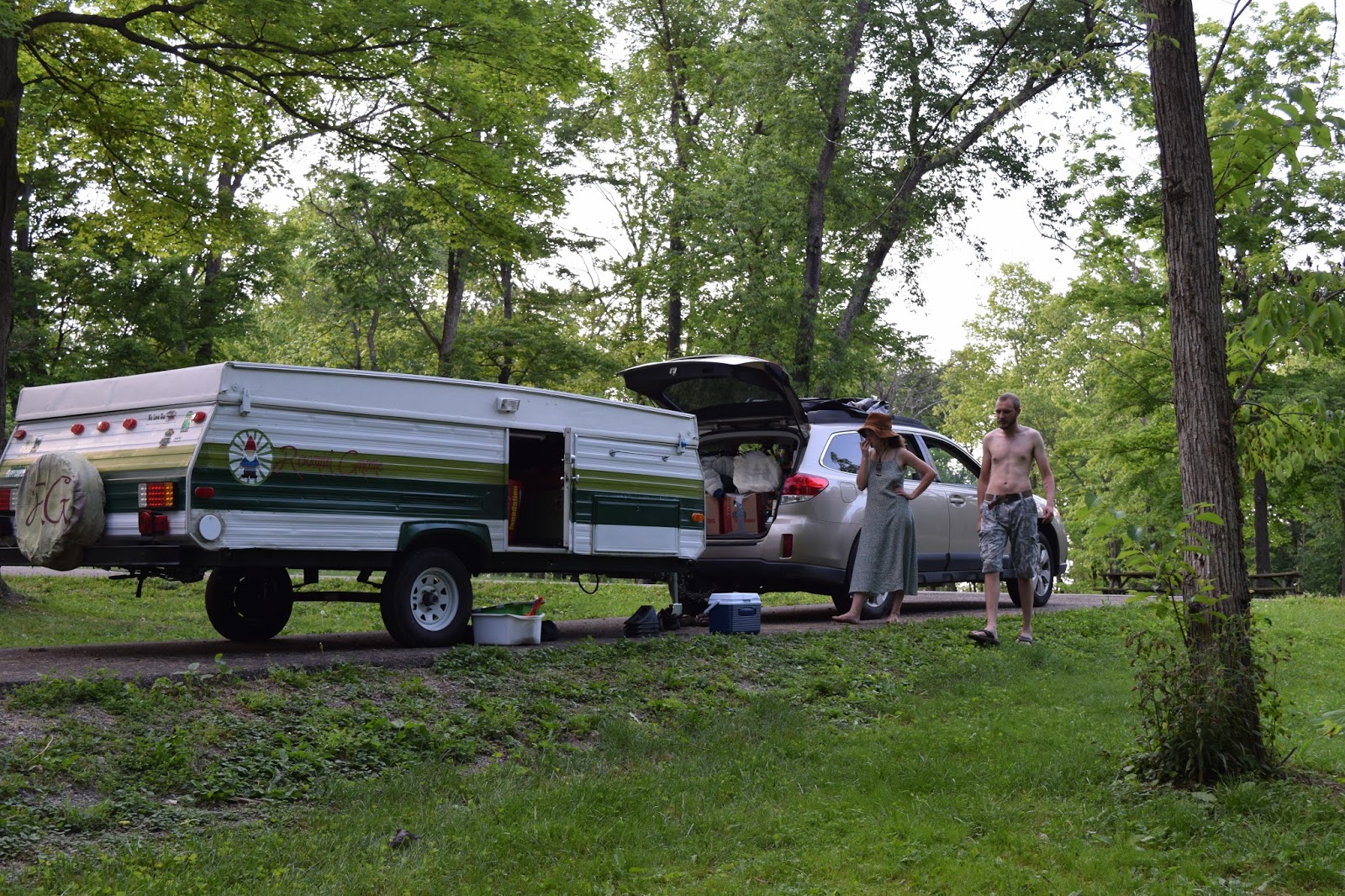
Leaving Portland, we hopped on the 5 heading South. A break in the weather gave us the opportunity for a dryer drive during the day. As the drive continued, light precipitation turned into a driving rain on and off until we reached the coast. Our stay for the night was anticipated outside of Coos Bay, OR on a tiny strip of BLM land. We scoped out the location in the dark, as is usual by now, and noticed a half dozen vehicles (vans, cars, trucks and an RV) parked in a large sand lot. This isn't really our type of camping spot so we ventured on further. A few potential locations were axed due to their inaccessibility from the rain. Other camping options in the area were for a paid site and with car camping, its senseless to pay $25 just to sleep in our vehicle in a parking spot. After about two hours of searching the region, we finally returned to the sand lot mentioned before, set up the car for sleep and let the rain continue to wash over the area.

In the morning, we broke camp fairly quickly and without much dismay. The rain let up and so we were able to dryly pack. The gnome continued South on the 101 for more sun and sand. The drive to Eureka CA was fairly uneventful and our BLM location was a complete flop. Having failed campsites numerous times in a week is stressful and draining at this point. A last ditch effort was to mosey down to the Bear River Casino in Loleta which offered free overnight parking for up to 72 hours. SOLD


This was the first time in our trip we humbled to the casino parking lot. [We have yet to stay at a Walmart overnight] It was actually a pretty good deal. We made a gaming profile at the front desk and got $10 worth of credit on the machines, then security wrote us a tag for the rig and we parked up in the rear lot with a bunch of other travelers including vans and a handful of RV's. It wasnt exactly the quietest night in the parking lot and the lights penetrated any little hole but we appreciated the free housing. Every so often, we would stroll down to the casino and put a dollar or two in the machines, use the rest rooms, and then work our way back to the camper. While in town, we had the opportunity to walk around the old town with its quaint shops and local vibe. We also visited Eureka Park near the zoo which offered short walks in a dense redwood park right in the center of the suburbs. Even though the rain was sporadic throughout the day, we put our smiles on a had a good time.


The second night at the casino, the weather forecast for our area called for a heavy rain event with high winds up to 35mph. At 2 AM, we awoke to the wind blowing the sails of the camper. It was decided we needed to pack up so we broke down the lot, made the car ready for the rest of our evening and turned in around 4 AM while the winds blew outside. Yuck. The next morning was clear and we made tracks to see the Redwood State/National Park including Fern Canyon and Lady Bird Johnson Grove; locations for fun finds from a friend of ours. When we checked in at the visitor center, they warned that due to the high amount of rain in the recent days, Fern Canyon was closed for the season but the road was still partially open. Deciding to drive that route, we traveled through dense lush vegetation and out to the beach. Grey overcast skies and hard waves pummeled the raw beaches as rivers flowed from the hills down to the sand. Eventually, we reached the point where Subaru would not do well without a snorkel and we backtracked just in time to find the road we came in on was now closed and we had to drive through a large, now-flooded, depression in the road. A short drive north brought us to the Newton B Drury Scenic Parkway with its hosts of giant trees and short trails to venture. The last bit of the day was spent in Lady Bird Johnson Grove which Liz and I particularity enjoyed. The 12% grade up the length of hills made us thankful the gnome was at home. As the rain started up again, we donned our rain gear and with exploration still in our boots, we mucked on through the trees to find hidden groves and mini mushrooms untouched by man; or at least that's how we felt in the Prehistoric lands.


On our way out of Eureka, we stopped by Chapman's Gem & Mineral Shop. We usually don't stop at many roadside attractions cause if you stop at one, you must do them all, but something called us to this shop. They had just opened for the day and we were in awe. The decor was nothing to call home about but the stones and specimens were museum quality from a man and his family who have spent decades collecting and organizing the lot. A fantastic time was spent and before we rolled out, a purchase of a pink salt lamp was made due to an amazing sale. Great roadside find!

101 South took us inland a bit and with hopes of continuing down the coast, we split towards Route 1 taking a very windy, wet and hilly road to where we wanted to be. Fort Bragg Glass Beach was our next destination and we weren't going to let the adverse conditions or roadways judge our path. We were ROAMIN! That beach was a trip. When we finally made it to sea level, the sand was littered with soft sea glass and other finds. Apparently, the overabundance of sea glass in this specific location is attributed to historic off shores 'recycling' operations. With pockets filled with sea glass, we hoped back into the car to reach our destination at a casino lot outside of Point Area, CA. 


The rain had stopped from the sky but the hills were over saturated and little streams ran from any nook or cranny in the sandy hillsides. An ominous sign flashed by on the drive stating the highway was closed in 30 miles. With a quick view of the GPS, we noted our destination to be only 29 miles away. Lucky! Well as we drove in the dark, Garmin had us take the last available left off the highway right before the closure. This short road went up a hill and then back down just to leave us facing a raging river that swallowed the road.

We pause for a second to consider options and we quickly figure this is an impasse and that backtracking is necessary. Well, the fool driving the car thought a K turn into a muddy alcove would get us turned about. It sure did get us stuck in the mud and with a heavy camper in tow, the Subaru struggled to get purchase for the reverse motion. Not only that, the execution of the turn was poor at best and a K turn would not work the way as planned. The headlamps go on and we assess the situation from outside. Emergency snow/sand platforms were smushed under the wheels for traction and with TC turned off, I backed the Subaru out the hole and with the remaining momentum, forced the rig in reverse uphill until we were safe.

Our plan B was to check out the KOA up the road. Signs said $35 a night just to have us car camp. No way Jose! In this small flooded town with no stores and very few options led to a brilliant but desperate idea. I brought us to the local Fire house and EMT dispatch and knocked on the door. After a moment of despair, the door opened and a guy asked what we needed. We gave our story of the lost traveler with no where to go for the night and no money for the KOA. Sympathy took hold and they let us use their gravel lot for the night to park our car and sleep. Before heading out the next morning, the local Sheriff rolled up and we chatted about the road conditions and he assumed it would be open by late afternoon. A small delay but we would be on our way.


Time was killed at the beach and by 11 AM, we pressed our luck with the road and sure enough, she was open for our continuation. By Jenner, CA, Liz has had enough of the twisty coastal road highway and we could escape to the inland route before reaching our destination outside of Oakland CA. Traffic around San Fran was to be expected as we arrived just as 'rush hour' started. Surprisingly though, our route took us to a very densely vegetated part of Oakland and once again, the road went wild with lefts and rights, ups and downs until we reached the beautiful grounds of Anthony Chabot. We were one of a few other folks camping that weekend and so it was quite the quiet campground which was nice; and for only $25 a night, we made the choice to spend 3 nights instead of 2 to give us more time to spend with friends.

Day one was spent exploring Oakland and its Chinatown district where we got some great grub and window shopped a bit. We also walked around Lake Merritt and fed the birds some seed at the wildlife sanctuary.


Day two, Liz and I ventured into San Fran to see a few things. With time restraints, we manage to see Pier 39 with its lovable seal platforms and shopping mall, Musee Mecanique on Pier D7 which hosts a range of coin op machines from the turn of the century and on, and Lombard street teaming with tourists. It wouldn't be a trip to San Fran without a visit to the Haight/Ashbury area so we drove over and took in the sights, signs and smells of the district known for its peace, love and hippie happiness. From there, we met up with Shayna and Ki once more at Golden Gate park where we planned a picnic in front of the Conservatory of Flowers. While there, noised from behind us garnered our attention to view a bike festival. Local bike crafters showed off their home builds which included highrise structures, one of which shaped like a tree, and a bike which transformed from a low rider to a 5 ft high prop job. Quite the sight.


Waking early the next morning, we broke camp for our next stop, Monterrey! The drive was short with minimal hassle and we arrived with plenty of time to meet our host. We met Cynthia and Steve at Dinkey Creek over the summer. They were memorable folks who we clicked with with us and also returned for a second surprise visit on our last week of work in the woods. Cynthia offer to take us to the Aquarium since her library offered 6 free passes to members for the year. We embraced the idea of a free amazing aquarium which would normally have set us back $100. In addition to free admission, we also received a warm, home cooked meal of meatloaf in trade for tales of the whimsy of our journey.


Our night in Monterrey was nothing outside the norm from what we were previously catching. Option one was to stay at the Laguna Seca raceway. When we arrived, the road took a steep turn up a 16% grade to the kiosk which was of course closed for the off-season. The signs showed closures at most loops and only left were the electric locations at $37.80 a night! Ummmm, no. Once again, we are too stubborn to pay such an outrageous amount just to sleep in a car. Option two was a hot tip online that led us a half hour up the road to Carmel-by-the-Sea's Safeway. Driving into the parking lot at 11 PM, we were welcomed by other small RV's and vans parked in the back lot. Of course we went into the store and asked the workers there what the deal was. They did NOT give explicit authorization and said that grounds teams patrolled the shopping area and would promptly ask overnighters to leave. With no more options for the night, we took a chance and parked out by the other sleepers. No beds were made and the car remained in travel mode in case we were expressed to leave the area. I personally slept a total of about 3 hours cumulative keeping an eye out for cops and patrol people.

Nothing came of it and we were rolling out of town by 7 AM. A stop at Moss Landing led us to Elkhorn Slough which provided a haven for sea otters. Those furry pups splashed in the water and sunned on the sand while we watched from afar with the binoculars. We also saw some seals and a few birds worth mentioning. The drive led us from the coast, back towards Dinkey Creek, to Thor's house were we talked of everything and nothing in particular. A beautiful sunset and stir fry capped our stay on the mountain that night.

In the AM, we worked our way down the hill and South through Bakersfield. The next destination before intercepting with family was to spend a few days in the desert for a nice dry and warm stay. Well, we sure didnt get it. Our stop in the Lucerne Valley was on BLM land and near a dry lake bed.

We arrived in pitch darkness in a drizzle. The light rain was unexpected since I assumed we would stay dry for our stay in the desert scrub region of southern CA. The gnome took to the sandy unpaved road and we drove into a wall of darkness down a dry lake bed. The darkness and lake of nothingness drowned out the headlights while the massive electric lines provided disorienting structures in the sky. Managing to stay on a path, we drove till a spot manifested and we popped camp. Over night and through the morning, more rain and low hanging clouds. Strong winds were forecaster for  the next day so we didn't have high hopes for a clear day :( We just couldn't shake the dreary weather. Luckily we had minimal plans and got cosy by the heater.


We attempted to Subie splash around in the now rehydrated lake bed and quickly took on mud. With TC off, I made quick work to turn us around and back once we came. Fortunately, the lake bed wasn't the only path in and out. We scoped a few routes to get us out of our camp spot as the rain continued. That night, we snuggled in but it wasnt long before I had to wake and evacuate my stomach. Something wanted out and it kept me up all night using the lands as a scattered target practice. The rain stayed off which was nice but my innards were broken by bug or bad food.


The next day and change I spent in a sleepy stupor, unable to eat or drink as a fever took over. With no imminent plans, we waited out the symptoms until ready to move on South to the final destination of San Diego for Christmas. On the day of our departure, my illness was easing back and we hitched the camper. Snow was topping the nearby peaks and grey clouds hung low. Certain parts of the road were flooded and hail happened in numerous short bursts on the drive. Even into the San Diego suburbs, hail and micro bursts hit the area inundating the inappropriate water systems. Roads and yards were flooded and beads of hail coated roofs and cars. Regardless, we made it to our destination for the holidays and were certainly happy about it. 

We have a dry warm home in the sun of San Diego. At least till Phoenix. Lets see it rain there!
THE GNOME WISHES ALL A
MERRY CHRISTMAS AND HAPPY HOLIDAYS.

Saturday, December 10, 2016

Wicked Weather Not Wonderful

When we left Saskatchewan, the frost was thick on the ground but the roads held true. Crossing the border back into the states, we had little issues coming back state side. As we approached our destination for the day, a truck passing the other direction kicked up a rock which made a small crack on the windshield; driver side. It quickly started to spread making it near impossible to fill for a temporary fix. The night was spent sleeping in the Subaru at Al's Mini Storage but don't tell Al. We figured it would save us an hour of driving and was the most secure camping we had ever done due to its padlock and barbed fence. In the morning, we hitched up the rig and headed to our next adventure. Travelling on Thanksgiving, the roads were fairly clear of other motorists for the length of the 7hr drive to western Montana.


The pr
oposed campsite for our stay outside of Missoula MT was about 15 miles outside of town at Johnsrud Park. After driving for 6+ hours with the gnome in tow, we reached what we thought would be our campsite for the night outside of Missoula Montana. The site at Johnsrud Park Road provided ample signs to say, day use only. Being the abiding campers we are, we followed signage for the campgrounds further up the road; only 5 miles.

With daylight dwindling and a light coating of snow on the ground, we pressed on. The paved road quickly turned to dirt and then to dirt with ice sheets on top. The road remained flat for some time until it then abruptly narrowed to one lane with a hill to the right and river on left. We pressed on with no turn around to name.

Then the hills started. The first had some grip issues but Subaru AWD held tight. The second hill had some good old jersey barriers to prevent falling into the river below. As I began the attempt, momentum was not my friend and about half way up, we slipped. The car begins to roll backward being pulled by the gnomes weight. I panic and hit all brakes which stops us quickly.

Option 1. Reverse down the icy slope with little control and see what happens.
Option 2. Floor it and see how it goes.

Well we try option one and I quickly begin to inadvertently and uncontrollably jackknife with the trailer heading to the rock wall and the Subaru to the river. BAD NEWS. We break again and then commit to option 2. Liz hops out to help guide the rig as I use the 'Floor It' option to slip, slide, then grip inch by inch up the 4% icy grade. The wheels spin with stress as the engine whirls in first gear. Its a last ditch effort with a lot to loose and no one around to save you.

The car holds ground and slowly works its way left then right then left again up the path. As we near the small summit, it trips and quits moving forward. I thrust my body forward towards the steering wheel and gain an inch. Again and again I repeat the moving till finally we are at the top. Out of breath and shaking, we decide our fate. Continuing is not an option so in the remaining daylight, we use the narrow space at the summit to turn around. I miscalculate the turn radius and bust a small hole in the bumper.

The rig is turned around and eased slowly down the hill it just worked so hard to get up. Luckily we had a plan B in place only 11 miles up the road. In darkness we drive and find the turn off easily enough. We take no chances and unhook the trailer in a flat parking area. We scope out the area and find a fire ring to call camp.

The next few days were wicked cold with chance of light snow. We managed to make the best of a chilly Missoula and do some window shopping along with a trial of some local brews. After a hefty flight at one brewery, we decided to enjoy a nearby park with swings, slides and amazing places to run and play. Sometime in the darkness at the park, Liz's cellphone fell out her pocket and was picked up by some tweens who preceded us. All we found left when we returned to try and find the phone was the case on the ground by the swings. Mega upset since phones are not cheap and we are very budget conscience at this point in our travels.

View of Missoula from a hilly hike

The weather decided to continue its flight into unfavorable and as we continually checked the weather forecast, the call for snow made us increasingly more nervous. We decided to move on before it all started. The next driving leg out of Missoula was a windy wintery mess as we hurtled over the i90 passes in MT, Idaho and Washington. The drive was completed at our next site which we made work. Tinkham Road, which is about an hours drive from Seattle, was our home for the next few days. It runs parallel to i90 but surrounded by thick woods which provided a great natural blanket from the rain and snow that continued to fall in the region. A tarp we saved from Dinkey Creek days provided a great rain repellent to keep the gnome dryer than not. With our weatherproof rig, we hunkered down and waited the weather out.

The next few days were spent exploring the Seattle area including a trip to their Ikea which was in a bizarre old trucking hub, a trip to Pikes Place market (the one where they throw the fish around), and a walk around some of the local gardens and parks including Kubota, a Japanese inspired garden.


We were very excited about our Pike Place visit because Liz was able to get her squished engagement ring reshaped and the stone reset. We had visited numerous jewelers and all of them said the ring would have to be sent out and the fix costing more then worth. Well this local jeweler was able to mend the issues in moments and charged a measly $15 for the service. I also purchased an opal set ring for my love since she is amazing.


The weather once again was calling for snow at our Seattle digs so we decided to move on a bit earlier to our next site. The destination was less than desirable since upon arrival, we noticed signs stating closed for the season; Dec.1 – May.1 It was the second time we had miscalculated the stay. Now with one phone between us and limited connectivity, we frantically searched for the next best thing. A swath of national forest to the north would do the trick. We pressed on making our anticipated 2.5hr drive into a 5 hour trek but what cha gonna do? We set camp at a fire ring, once again not sure if we were allowed to camp there but we never received warning to remove our rig.

Our explorations around the Olympic Peninsula was divided into two days with a night of car camping spent near Port Angelas. We headed clockwise through the dense coastal rain forest with the mighty Pacific to our driver and Mt. Olympia to the passenger. We made sure to stop at some of the beaches to appreciate the incredible views. 


Carrying on, we ventured through Forks, the town known for the Twilight saga, and traveled to La Push, the western most town on the 48 continental states. Cool. We really enjoyed being in such a lush, dense, mossy green world. Things were starting to look up for our trip. That night, we bedded down on a forest road to awake to a frosty morning.


The remainder of the trip around the peninsula had few attractions but we settled on seeing the Hamma Hamma trailhead. The road quickly showed signs of the snow the night before but had tread marks from other adventurers. As we passed the trailhead, all tracks stopped but the road continued. Feeling curious, we continued up the snowy road. With no camper to weigh us down, the AWD held fine on the road. That is until we reached the ruts. The snowy surface had filled some previously made ruts and the car was finally deemed out of its element. We tried to K-turn but the ruts got us stuck for the better part of a freezing 45 minutes as we tried all tricks in the book to free the car from the slippery snowy ruts which held us tight. Using sticks, sweat, and perseverance, we freed ourselves and headed back down to safety. Not willing to risk anymore hardships, we stayed smart all the way back to the gnome for the night.


The next leg of the trip was accomplished before a heavy snow was to roll through. South we pressed towards Portland. The next site was a sure bet with numerous reviews and what we though would be easy access. As we arrived in the dark, the road split and we were to take a near %10 grade on gravel up to the sites. I backed the rig up and then gave it gas. The car had momentum but it just wasn't enough and it quit %70 up the hill. All brakes were used and I cautiously backed the load down the steep hill with Liz using flashlights to help the descent from landing us in a stream or down the embankment. What to do when you cant make it to your destination? Once again we hit emergency mode and find a nearby RV park which set us up for the night at $25 per slumber. Not ideal but we needed a place to crash.

The next morning, we woke to weather forecasts of strong wind gusts and snow for the area. Feeling defeated, we were packing up to leave Portland when Liz made a call. Her father gave great insight as to our plight and with a gracious gift, gave us a hotel for the night near Portland where we could have a warm bed, shower and place to put the camper. We are ultra thankful for this lifeline which might have seemed small to him but saved our butts from the ice storm that paralyzed the city in the next few hours. Sheets of ice, snow mix and high winds caused trucks to fail on small inclines on the highways. Traffic was a mess and apparently, Portland's single plow truck was nowhere to be found. We buckled down for the night to stay safe and warm.

The next day, we met with Lauren, another one of Liz's friends, and did lunch in the city. Lauren invited us to stay the next few nights with her while we figured out post-Portland problems like our inability to make it to Bend OR. While we were able to spend time in Portland, we made sure to check out some awesome, unique shops, try amazingly delicious foods, meet interesting folk and also got to a craft convention where a hundred or so craters displayed their beautiful artwork, jewelry or brilliant gift ideas. Unfortunately, our budget couldn't afford most of the things our eyes desired.


Up next is more coastal cruising south for Xmas. Hopefully, the weather will warm, nothing breaks and sites work out fine. Fingers crossed our luck improves.

An Afternoon or two in Saskatoon

In mid November, we headed north into the great unknowns (at least to us). Our intentions were to zoom up to Saskatoon Saskatchewan to visit Nancy, friends from Liz's Susquehanna U days. We drove north but made sure to plan smart. Since we were crossing the border the day after Trump became President elect, we dropped the camper and non-essential gear in Malta MT at Al's Mini Storage. It cost about $60 for a month of storage which was fine by us; it gave us the ability to ease us through the border crossing. The Canadian border patrol were still skeptical of our travel plans since we don't have jobs or a house that ties us to come back to the US. They searched our car thoroughly along with a search of our cell phones (which is a mild invasion of privacy but what can ya do). After two hours of friendly interrogations, we made it across and met Nancy at her fiancee's parents house in Swift Current SK. From there, we were welcomed with open arms from an amazing family. A day trip to the Froslie Farm gave the doggo's an opportunity to stretch their legs and for the adults to play with some fun farm toys. Liz and Nancy operated the two seater while I worked the quad. It was a blast zipping around the fields and orchard. And speaking of doggo's, Ziggy and Timber got along great since the moment they met.


Lets go buddy!

Another Canadian adventure while we were in town was to visit Prince Albert National Park. In case you are unaware, Saskatoon and its surrounding farm land is incredibly flat and lack of tree life. Prince Albert NP was a densely forested lake in the 'hills' north of the city. We got to walk a few short trails and climb a viewing tower which gave a nice vantage point from above. Other activities we enjoyed while visiting our friends to the north was the Saskatoon Zoo which was free and had pretty good exhibits and a very friendly red panda. We also went to the Festival of Trees which displayed a range of crafted Christmas trees on display and for sale too. It was in a expo center which also had a historic boom town recreation built in it including shops you would walk through and see how life in the past was.

Prince Albert NP 


A forest trail in PA NP

The best part of the trip though was the ability to be with warm friendly people during the holidays. We were able to celebrate Friendsgiving with Nancy, Jessie and a handful of their close friends who could make it. For the event, the house spared no expense on a beautiful turkey, all the fixins and a boatload of booze that mostly went untouched. With Canadian company, we played Cards Against Humanity with some of the card references being misunderstood or under appreciated. Apparently they have a Canadian version with things that probably would relate more to their northern pop culture. The day before real Thanksgiving, we packed our gear and headed south the border to reunite with the gnome in Malta. We spent about two weeks in Saskatchewan which gave us a great opportunity to meet with friends, make new ones and get our plans straightened for the next leg of the trip down the Pacific Coast, a venture which is currently turning out to be much different than the plans called for. Read more about our Montana miscalculations and other near disasters from the north in the next post.

Heading out of Saskatoon with frost nipping at our heels

Monday, November 14, 2016

֍۩ Campground Review List ۩֍

I have been meaning to get around to this for some time now. It's a daunting task but hopefully it will help any fellow travelers (current or future) who might be reading to find a great campsite for their upcoming trip. A majority of our journey has encompassed California and Utah which are both very beautiful states. Nonetheless, the following will be an ongoing list which will be improved from time to time to include our findings as we continue our tour.

It all started on the East Coast with a dream of adventures. With the huge help of Freecampsites.net, we were able to locate amazing ((and not so amazing)) places to spend a night or longer while we were in 'town'. Freecampsites.net is a user based system where just about anyone can post new places to stay. There is a moderator team to weed out the junk but for the most part, this website has been extremely helpful. The best feature is the user reviews which gives you the actual down and dirty facts of the sites. Locations without review are a bit scary since you don't know what to fully expect but sometimes its the only option in your region and you have to take the plunge. Once you do know the deal however, its best to login and let others know how it went. The database is always improving and we rarely have technical issues with the site. Oh yeah, and the App is just a link to the website so just cut straight to the chase. Be sure to click the Campground name for a link to more information.

As with any campsite or boondock location, always abide by the law of the land including fire safety, adherence to private property/trespassing, trash pack-in/pack-out, proper waste management and attention to potential wildlife like bears, snakes, coyotes, moose, deer, raccoon, skunks, tarantulas etc.

--We are currently also looking at the Campendium website for secondary references. We have yet to try sites listed on there but assume its a very similar structure.--

-JUNE-

11 Twp Rd 181, Bloomingdale, OH 43910
Bloomingdale, Ohio
GPS: 40.334339-80.764242
Elevation: 1176'

[Camped here for a one nighter on the way through town. Easy enough to find and the long paved sites are great for any rig. Along side each platform is a nice large camping area with ring and table. We arrived during a cicada emergence so the noise was incredible but this was the anomaly. The gun range nearby also allowed for some outside noise. The water tap onsite is listed as non-potable and the drop toilets on site were standard.]

--------------------------------------------------------------------------------------------------------------------------------

Hohenwald, Tennessee
GPS: 35.522797-87.455078

Elevation: 955'


[Once again, another one nighter through town. Merriwether was an unexpected stop but well worth it. A bit off the beaten path, nestled in the wood, the smaller sites have good pull through or back-ins pads well paved for any sized rig. Fire pit and tables included and FLUSH toilets on-site were well cleaned. There was spot for campground host but none present at the time.]

--------------------------------------------------------------------------------------------------------------------------------

Sanford, Texas
GPS: 35.70639-101.559998
Elevation: 3012'

[A one nighter to remember at this beautiful campground. We arrive in late afternoon and set up camp at one of the top pavilions. Each site has a pit and picnic table with sturdy pavilion on pad. Sites are on the smaller side and limited privacy if full. Flush toilets and water for rigs provided and an amazing view of Lake Meredith. We watched a storm roll in from afar and by midnight, intense winds and lighting pushed us into the car for the night. Not the best nights sleep from the freak storm]

--------------------------------------------------------------------------------------------------------------------------------

HWY 117
Grants, New Mexico
GPS: 34.941908-107.820155
Elevation: 6898'

[One of our favorite sites was located at this desert site. The location was fairly vacant but the slope and vegetation allowed for better privacy. Each site had a shade pavilion and picnic table (no fire pit) and great views of the lava flow lands to the west. Mind the dip at the entrance to the CG which might get some towers stuck in the rut. Unpaved lots might be more difficult for some rigs. Drop toilets on site were clean and cared for during our visit.]

--------------------------------------------------------------------------------------------------------------------------------

Bryce Canyon, Utah
GPS: 37.721502-112.254688
Elevation: 7816'

[The first night we were in this region, we stayed in the paid Dixie NF campground. With a short drive, we found this location on a whim and set up camp on one of the turnouts. SUPER Private sites off the beaten path with improvised fire rings. Might be a bit windy on some of  the Mesa sites but incredible views and no outside noise. Close to Bryce and Dixie with a medium drive to Zion. No other amenities so bring your own facilities and water.]

--------------------------------------------------------------------------------------------------------------------------------

29450 Valley of Fire Road
Overton, Nevada 89040


[Stayed at this location outside of Las Vegas area. A $20 fee ($30 for hook-up site) is charged for the use of camping areas and is payable at the campgrounds. All campsites are first-come, first-serve. There are two campgrounds with a combined total of 72 units. Campsites are equipped with shaded tables, grills, water, and restrooms and have minimal privacy. A dump station and showers are available at cost. Facilities were clean but well used.]

--------------------------------------------------------------------------------------------------------------------------------

Hope Valley, California
GPS: 38.765404-119.940048
Elevation: 7111'


[Spent about two weeks at this busy site +/- the July 4th holiday. Ripe for off road rigs including dirtbikes, quads and buggies, this location is very popular with all sorts. About 40 minutes from the S Tahoe Region, this camping area allows for about 20 unimproved sites with improvised fire rings. A short but difficult '4x4 suggested' drive gets you to Scott's Lake with amazing views of the mountains and pines. A must see. No other amenities so bring your own facilities and water.]


--------------------------------------------------------------------------------------------------------------------------------


-JULY-

Occupy Dinkey Creek

-AUGUST-

Occupy Dinkey Creek

-SEPTEMBER-

Occupy Dinkey Creek

Coalinga Road
King City, California
GPS: 36.368169-120.83103
Elevation: 2861'


[A weekend trip led us to this small 5 site campground in the hills west of Fresno. The location has a few other campgrounds which support more/larger rigs but this one was right for our tenting that time. The sites were small so leave the giant tents and supplies at home. Drop toilet was clean and the sites were well maintained. Good view from the top sites and private camp locations provided for a good time. Take the hike past the metal barricade for some amazing Serpentine rock samples which shimmer in teals, blues and purples. Also, a season waterfall is a 3 mi. hike down the trail. No water or shops nearby so BYO]


--------------------------------------------------------------------------------------------------------------------------------

Lakeshore, California
GPS: 37.33314-119.15334
Elevation: 7828'


[Spent a weekend at this location while exploring Mono Hot Springs, a free use series of hot springs in the hills past Kaiser Pass. This location was great because it was free AND we were allowed camp fires. Each location has a fire ring and one or more well used picnic tables. Drop toilets were well worn and could use updating. Look for the last site to the right of the metal barricade before the bridge. Very private with lots of wooded areas to explore and enjoy right by the stream.  No water or shops nearby so BYO]


--------------------------------------------------------------------------------------------------------------------------------

Dinkey Creek Road
Shaver Lake, California
GPS: 37.096035-119.296593
Elevation: 5743'


[Numerous roadside pull-offs allow for camping in the woods of the Sierras. We made camp at a pull-off from Swanee Road (no signs/see GPS suggestions) at an established camp. Mind the fire restrictions in place and also note hunting season if applicable. We bought Ziggy a high-vis vest after hearing numerous gunshots in the area. Safe none-the-less and right outside of Shaver Lake which offers small scale convenience stores, places to eat and outdoor outfitters. Roads are unimproved, dirt, or gravel with potential for heavy rutting. If you bring a big rig and want  deep spot, best to unhitch and do some homework before travelling the route. Stay away from the first pull-out which becomes super crowed and opt for a more private location. No water or facilities so BYO]

--------------------------------------------------------------------------------------------------------------------------------

-OCTOBER-

Mount Raymond Road
Fish Camp, California
GPS: 37.491415-119.624698
Elevation: 5276'


[Right outside the East entrance to Yosemite, this area was great for a short stay with numerous small locations to park up and stay. A lot of spots were on a hillside and not great for large rigs but tents will do fine. The flatter spots tended to fill up quickest so stake your claim ASAP. Also, RV's parked on the paved pad which was level and sturdy. Access road is gravel in great condition and landing has a bear-proof large garbage nearby for your trash. Other than that no water or facilities so BYO]

--------------------------------------------------------------------------------------------------------------------------------

Picnic Grounds Road
Lee Vining, California
GPS: 37.944889-119.093529
Elevation: 6732'


[Excellent site off the beaten path and a short drive from the Mono Lake Tufa's, Lee Vining and the East Entrance to Yosemite. Follow the narrow sandy path to your private location of choice to set camp under the stars in the vicinity of volcanoes and massive mountains. Make sure to mind the potential for coyotes in the area as we had a pack howling each night. No water or facilities so BYO]

--------------------------------------------------------------------------------------------------------------------------------


Main Street
Big Pine, California
GPS: 37.173313-118.289261
Elevation: 3960'


[We originally attempted to make it through to the campground near the Ancient Bristle Cone Pine Forest but with night upon us and a long day of driving behind, we opted for this paid location at the foothills of the ABCPF. Liz made use of the affordable showers and the clean bathrooms onsite were nice to have. The sites are small and cramped but fine for a night or two. It is right off the highway so noise is a bit of an issue throughout the night. Hook-ups are available for a nominal fee in addition to the normal cost. A campground host is present so this is a no-party zone. Potable water from the spigot is provided.]

--------------------------------------------------------------------------------------------------------------------------------

39.282993, -114.949613
Ruth, Nevada
GPS: 39.282889-114.949555

Elevation: 7290'


[Arriving late at night and leaving early the next morning, we had little time to explore the area but the camping did the trick for what we needed. Follow OFFICIAL signs for Garnet Hill (seeing as how our GPS tried to take us down the worst dirt road ever), and make sure to keep momentum as you tend to the hill. We found camping spots along the left side of the road as you near the summit. At the top is a drop toilet well kept and few tables but actual camping at this area might not be allowed. Find your camp off the dirt road and use already established fire pits. Make sure to whip out your hammer and smash some rocks to search for some deep red garnets. Ely has grocery and gas nearby to restock.]


--------------------------------------------------------------------------------------------------------------------------------

Hanksville, Utah
GPS: 38.277878-111.130745
Elevation: 5171'


[A beautiful place to boondock, this location is right outside the boundary of Capitol Reef and sits atop a mesa. We encountered a freak wind event which led us to a lackluster nights sleep in the Subaru. None-the-less, a fairly easy camp to access in most/all rigs with user built fire rings. Fairly flat parking provided a good spot for most setups and privacy is OK if your neighbors aren't too close. No water or facilities so BYO]

--------------------------------------------------------------------------------------------------------------------------------

191 and Yellow Circle Road
Moab, Utah
GPS: 38.435474-109.427631
Elevation: 5298'


[A great location on the southeast side of town, this camping area accommodates numerous groups with limited privacy. The exposed sites offer great views of the surround landscape and sunsets and has a few trails to explore up the hills. 25 minutes outside of town and about 40 mins to Arches, this site is a bit further but less popular than the overcrowded locations to the west of the parks. We spent the better part of a week at this location while enjoying the area. No water or facilities so BYO]

--------------------------------------------------------------------------------------------------------------------------------

Lake Como Road
Blanca, Colorado
GPS: 37.526985-105.593536
Elevation: 7680'


[This free site is good for a half dozen campers at the foothills near the Great Sand Dunes of southern Colorado. The road slopes up towards the mountains so level ground might be hard sought unless you can (and want to) snag the immediate sites on the flat. The road is quite wash boarded so watch your speed and position. Little privacy aside from distance from neighbors and no nearby amenities. No water or facilities so BYO]

--------------------------------------------------------------------------------------------------------------------------------

Road 254
Utah
GPS: 37.601438-109.923472
Elevation: 6998'


[A quick overnight between locations led us to this location. It is close to Natural Bridges National Monument and offers a handful of pull-off locations along a dirt road. I would not recommend for larger rigs and those that cannot clear a gap. The area is prone to wash-outs so be careful before and after heavy rains. We set camp in a wooded nook for the night. No towns or amenities to speak of so BYO.]

--------------------------------------------------------------------------------------------------------------------------------

Lockhart Rd
Moab, Utah
GPS: 38.1795-109.66695
Elevation: 4917'


[Another favorite location in the middle of the desert and a stones throw from Canyonlands Needles District entrance. This no frills series of sites along Lockhart road offer nice private locations and stunning views of the surrounding canyons and valleys. Take some time to explore the local climbing features on the red slick rocks. We spent two night but would stay more if we had the time. No towns or amenities nearby so stock up and BYO.]

--------------------------------------------------------------------------------------------------------------------------------

-NOVEMBER-

Logan Canyon, just past 2nd dam
Logan, Utah
GPS: 41.746998-111.733063
Elevation: 5036'

[A one nighter while passing through left us with Logan Canyon. At this time of year, sites were closed and gated along this road so be prepared to reroute. In normal season though, this camping location is prime with people along this major road. We did not specifically stay in this listed location but there are numerous sites along the road to camp up at. We stayed along the river and left in the early AM to continue our journey. Potable water and toilets may be available depending on the season.

Ennis, Montana
GPS: 45.443633-111.706658
Elevation: 4836'


[The beautiful mountains of Montana gave us an amazing background for our two nights outside of Ennis. The quiet and semi private campsites allowed for a good nights sleep along the banks of the lake. Fire pits and picnic tables provided along with a clean and stocked drop toilet gave this campsite two thumbs up. Ennis' small town western feel synced up with its nearby access to Yellowstone's western entrance. Great campground at a great location.]


--------------------------------------------------------------------------------------------------------------------------------

Saco, Montana
GPS: 48.488739-107.531288
Elevation: 2247'


[A mighty fine site along a lake once more provided us with a safe and quiet place to spend the night. Large pavilions with numerous picnic tables and improved fire pits allows for large groups to attend. There are also numerous drop toilets along the banks for easy access. The campsite is a bit out of town so be sure to stock up  on goods. The nearby Sleeping Buffalo Hot springs is said to be a treat in its newly renovated form. We were unable to attend since they were closed on Mondays and Tuesdays.]


--------------------------------------------------------------------------------------------------------------------------------

CURRENT AS OF NOV 15.